
On a drive home from Grand Teton National Park in Wyoming, we realized we were paralleling parts of the Oregon Trail. To make the drive more interesting, we decided to stop at various sites along the trail (even though we’d be taking it in reverse from the original travelers). This made an otherwise long drive a lot more fun, which is great for the drive home when most of the excitement from a fantastic trip is behind you.

Wyoming
Wyoming was full of interesting sites right along the highway. We stopped at Split Rock, Devil’s Gate, Independence Rock, Oregon Trail Ruts State Historic Site, Register Cliff, and Fort Laramie.
Split Rock
Split Rock was a navigational marker for folks on the Oregon Trail. It took them two days to reach the rock after they first saw it in the distance. Split Rock appears to have a large notch missing from the top of the rock formation, which makes it a little easier to spot. To read more about Split Rock, you can visit the NPS page here.


Devil’s Gate
Devil’s Gate was a narrow canyon in a large rock wall. A river ran through the canyon and wagons had to go around. There was a large pull off with a viewpoint of Devil’s Gate right off the highway, which was great for us as we were towing the camper at the time. There was another small road that led further away from the highway with additional Oregon Trail sites, but we didn’t venture down this road because we were uncertain of our ability to navigate at the other end with the camper. Here is a link to the NPS page with more details on Devil’s Gate.

Independence Rock
Some trappers celebrated Independence Day at this massive rock and just like that, it received its name. While the rock itself is interesting because of its size, the names and messages from Oregon Trail travelers carved into the rock give it even more historical significance. A link to the NPS page for this site can be found here.


Oregon Trail Ruts State Historic Site
This was so interesting to me! There were actual ruts and carved out paths in the limestone rock from repeated use by the wagon trains. Some of these ruts/paths are as deep as five feet. More info can be found on the NPS page here.


Register Cliff Historic Site
Register Cliff was our next stop heading east. It is just down the road from the Oregon Trail Ruts site. As you may have guessed from the name, people would sign and date the rock known as Register Cliff. Additional information can be found at the NPS page here.


Fort Laramie National Historic Site
Fort Laramie was much larger than I expected. While most of our other stops involved quickly hopping out of the truck for a short walk and some pictures, we probably spent at least half an hour walking around Fort Laramie (and easily could have spent more time). A link to the Fort Laramie NPS page can be found here.


As you can see, we made quite a few stops in Wyoming, but there were still many sites we passed up. If you’d like to read more about all Oregon Trail sites in Wyoming, here is a link to the National Parks Service Oregon Trail – Wyoming page.
Nebraska
After we left Wyoming, we moved onto the Oregon Trail in Nebraska. We stopped at two sites: Scott’s Bluff and Chimney Rock. There didn’t seem to be as many sites right off the road for an easy, quick stop. It also appeared that several sites in Nebraska were run by the state park service and required a fee. Because we were generally making such quick stops, we weren’t interested in stopping somewhere that charged an entry fee.
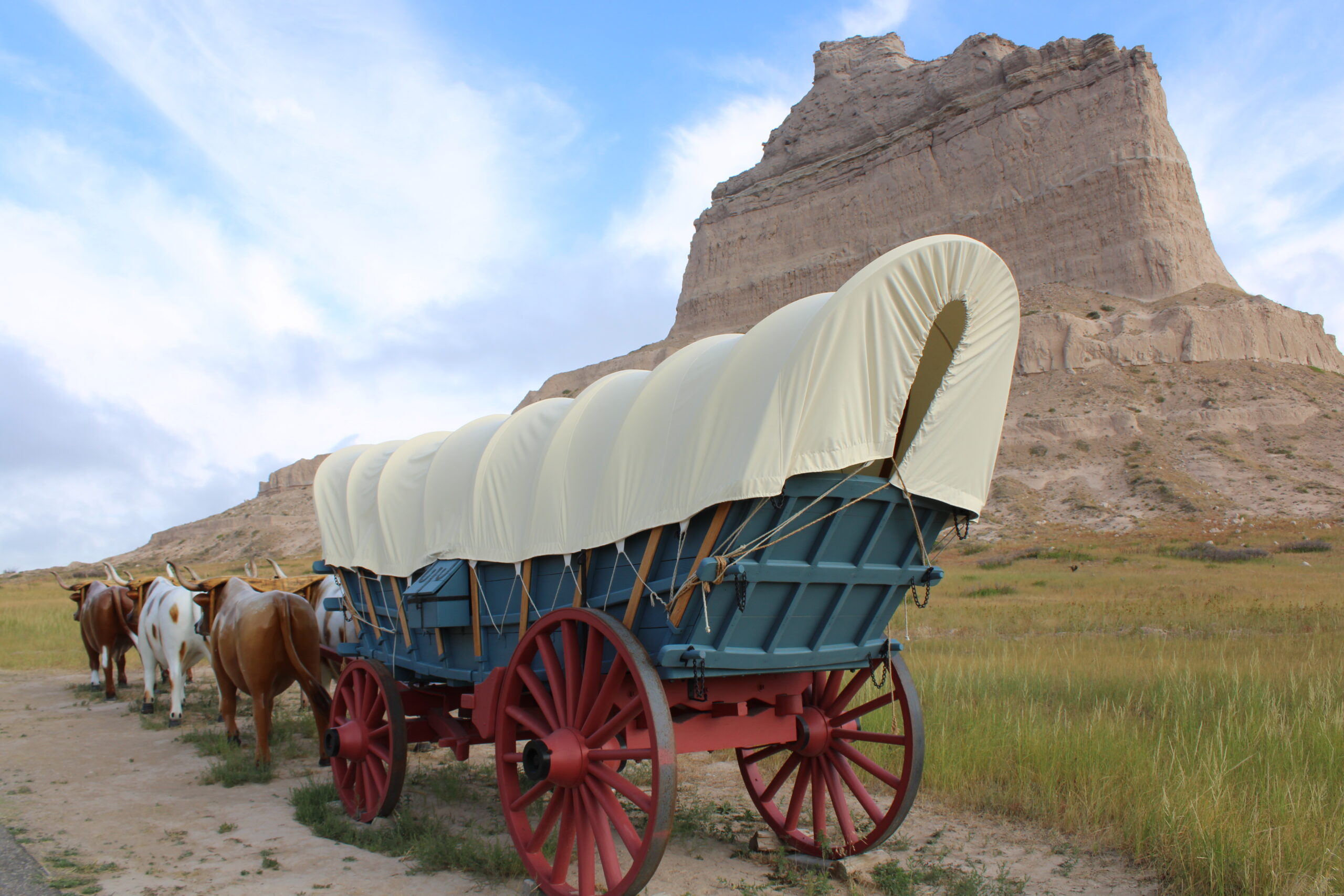
Scott’s Bluff National Monument
Scott’s Bluff National Monument is located just outside the city of Scott’s Bluff, NE. At both Fort Laramie and Scott’s Bluff, there were covered wagon replicas. I’ve seen pictures of these wagons over the years, but it was cool to see a replica up close. Some of the actual Oregon Trail path was preserved inside the park. Scott’s Bluff was neat because of the historical aspects with the Oregon Trail, but also the larger-scale geographical aspects.


We hiked a trail up to the top of the bluffs. Although the trail wasn’t terribly long (approx. 3 miles roundtrip), it was quite a climb, particularly as the day warmed up. This trail had little shade. It did have a tunnel carved through the rock, which was nice and cool. There is also a road leading up to the top of the bluff, but we would have had to unhook our trailer to drive to the top. The hike was a great opportunity for us to stretch our legs before continuing on our journey home. To visit the Scott’s Bluff National Monument NPS site, click here.
Chimney Rock
Chimney Rock was a very quick stop on the side of the highway. There was a designated pull off area where you could take a photo of Chimney Rock in the distance. More info about Chimney Rock can be found at the NPS site on the link here.

There were many more stops we could have made in Nebraska. For a complete list of Oregon Trail sites in Nebraska, visit the NPS Oregon Trail site here.
Final Thoughts
Although it felt like we stopped at a lot of sites, there are many, many more Oregon Trail historic sites that we did not visit. For a complete list of sites by state, visit the National Park Service Oregon Trail sites by states breakdown here. I found this to be hugely helpful when planning our stops. I also downloaded maps and site info on the NPS app, so I had this information handy even when we didn’t have cell service.