
We finally made it to the San Juans, and they did not disappoint! The San Juan Mountains are in southwest Colorado. We explored the San Juans specifically in the Silverton/Ouray area along the Million Dollar Highway.

The Million Dollar Highway
The main feature that drew us into this area was the Million Dollar Highway. We drove it from Silverton to Ouray and back. We love a scenic mountain drive, and this one was spectacular! Some of the mountains had a reddish tint to them. This really popped next to the green trees and the blue sky. There were also remnants of old mining operations that could be seen from the highway. We drove along ledges, through a tunnel, and over a waterfall.

Ouray

Box Canyon Falls
We drove the Million Dollar Highway from Silverton to Ouray. In Ouray, we explored Box Canyon Falls. At the time of our visit (June 2024), it was $7 per adult to visit the falls. A short trail from the visitor center/ticket office leads to the box canyon. They actually built a walkway mid-way up the canyon wall, so you can basically walk right up to the falls. There are also steps that lead down to the water level.

After exploring inside the canyon, we took a side trail to the top of the canyon. This trail was much less crowded, but it was a fairly steep climb to the top. Along the way, we had a great view of the town of Ouray. At the top, we were able to cross the canyon on a bridge and see the waterfall from above.


The Town
We had a delicious dinner (with a great view) at Goldbelt Bar and Grill right off the main road through town. Then we walked the town a bit. There were shops with souvenirs and shops that sold outdoor/hiking gear. While walking along the main road, we saw a sign with a drawing of a block of buildings in 1890 and 1908 positioned in front of the same block. We thought it was really cool to see how this area changed over time and compare it to present day.


We hoped to have a similar evening in Silverton, but we were rained out, so I’m glad we were able to spend time in Ouray!

Hiking
Quick Facts
- Length: Approx. 8 miles roundtrip
- Elevation Gain: 2700 feet
- Trailhead: Parking lot at the end of Forest Rd 585 (off of Highway 550 – The Million Dollar Highway)
- Link to the Ice Lake page on the National Forest website

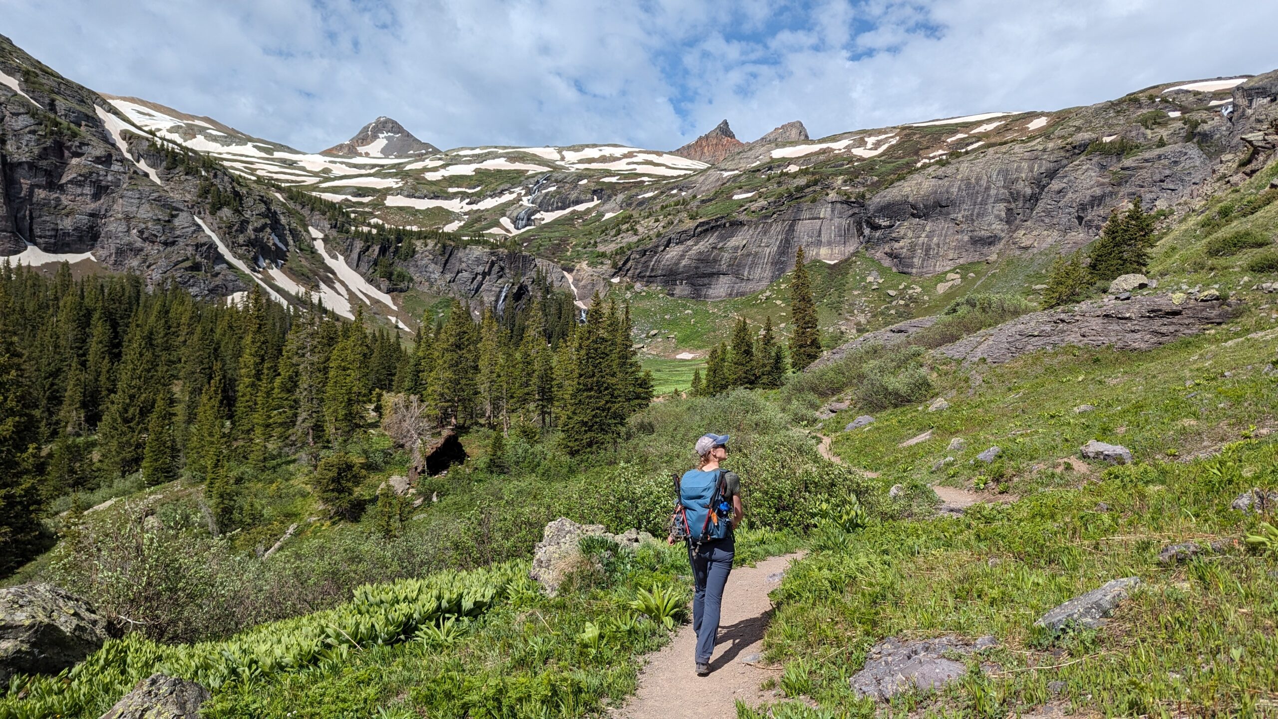
We hiked Ice Lake Trail to Ice Lake and Island Lake. This trail had some amazing views! It passed by waterfalls, crossed creeks, and meandered through a huge mountain meadow before reaching the first lake (Ice Lake). Then we hiked along a ledge toward Island Lake.


It was mid-June when we hiked this trail. We had to walk over a few snow patches and the lakes were still mostly covered with ice. It was actually kind of cool to see so much ice and snow at these high elevations, but I’d also like to return someday to see the beautiful blue water of the lakes and lots of wildflowers along the way.

Camping
We camped at Molas Lake Campground just south of Silverton. This was a beautiful campground and a great location! There were no hookups, but there were a few other RV parks in the area. There are also many places to boondock along the Million Dollar Highway. We passed quite a few boondocking sites on the way to Ice Lake Trail. We wanted the peace of mind of having reservations ahead of time, but these boondocking sites had incredible views!
