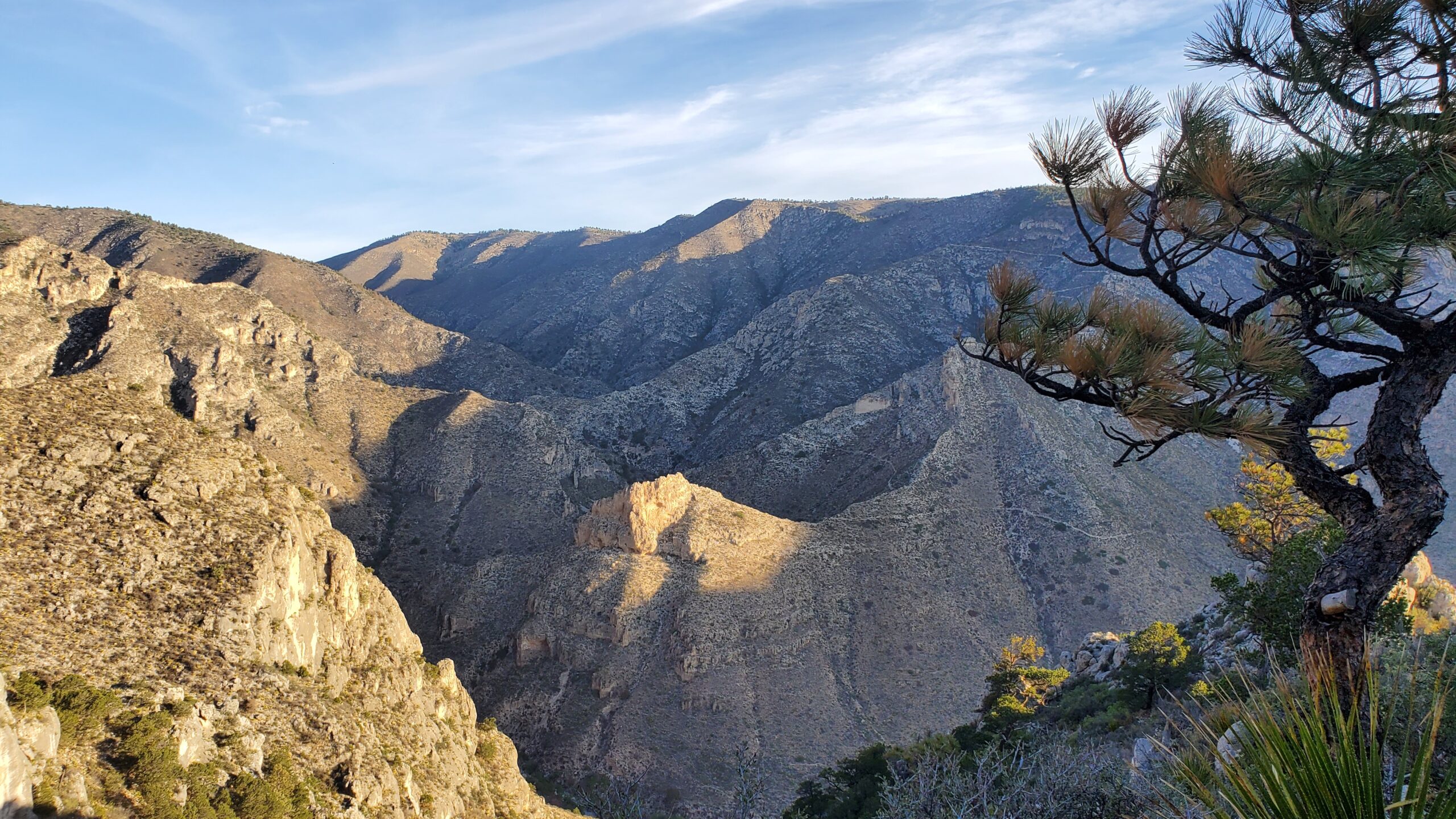
You may not have heard of Guadalupe Mountains National Park, but you’ve probably heard of its neighbor to the north, Carlsbad Caverns. Guadalupe Mountains is about 45 minutes south of Carlsbad Caverns. Guadalupe Mountains National Park is, in our opinion, one of the most underrated national parks in the US. It’s a beautiful park with lots of hiking trails and a blend of mountain and desert scenery. It is also home to the highest point in Texas at 8,751 feet about sea level.

Hiking
Devil’s Hall Trail
- Length: Approx. 4.2 miles round trip
- Elevation Gain: 548 ft
- Trailhead/Parking: Pine Springs Trailhead
- Link to NPS site
We arrived at Guadalupe Mountains later than expected, but we were still able to squeeze most of this hike in in after an early dinner. This wasn’t a bad time to hike because the temperature started to drop from the heat of the day. We just had to watch our time to make sure it didn’t get too dark on us, which meant we turned around before completing the entire trail. It was still a great hike – definitely worth squeezing it in.

It is labeled by the NPS as strenuous due to portions that are difficult to follow/find and required scrambling over large rocks and boulders. This certainly made it more challenging, but also added an element of excitement to the hike. We had also downloaded this park to our phones from the NPS app, which meant we had trail maps with our current GPS location on our phones. We could use this to confirm we were on the right track.

A large portion of the trail followed a dried river/creek bed deeper into the park. Eventually this led to the staircase, which was much larger than I expected. It was at this point that we decided we better turn around and head back to camp before it got dark. Fortunately, our campground was right at the trailhead.

Guadalupe Peak Trail
- Length: Approx. 8.4 miles round trip
- Elevation Gain: 3,000 ft
- Trailhead/Parking: Pine Springs Trailhead
- Link to NPS site
We started this hike early in the morning. We were on the trail before sunrise in an attempt to hike up to the peak and back down before the temperature rose too much. This was a steep climb! We climbed switchback after switchback and then finally started to head deeper into the mountains.

I’m glad we decided to get an early start because, especially in the switchback portion, there is little shade on the trail. As we climbed the switchbacks, we were able to watch the campground fade into the distance.

After heading deeper into the mountains, we crossed a wooden bridge connecting the trail along a ledge. Soon after, we began the final climb to Guadalupe Peak. There is a marker at the top of the peak, which is the highest point in Texas.
Camping/Lodging
Camping is going to be your best bet if you want to be in/near the park. When we visited, we camped at Pine Springs Campground, which was especially convenient because this was also at the trailhead for the two trails we were hiking. Pine Springs has a tent section and an RV section. At the time we visited, the RV section was first come first served only, which meant we couldn’t make reservations. This was a bit nerve wracking because we knew we’d be arriving later in the afternoon. Fortunately, we were able to get a spot. The RV campground is really just a parking lot with extra-long RV sites, but the scenery was so amazing, this didn’t bother us. You can now make reservations at this campground.

This was also our first-ever dry camping night, which was exciting for us. At the time, we didn’t have solar, and we only had one battery on our camper, so we weren’t sure how it would play out. We had a great time, and we had no issues running out of battery power. At the time, our fridge didn’t run on the battery, so we moved our food to a cooler.
When to Visit
We visited in late May 2021. Because we hiked late or early in the day, we didn’t have heat-related issues. It cooled off nicely in the evenings, but the afternoon was hot. I’ve read that the most popular month to visit the park is March. If we visit again, I will aim for a cooler time of the year. Also, keep in mind that this is a remote park. Be prepared when you visit the park because it will be a decent drive to a town with amenities.

Wish List
There were other trails and other portions of the park that were on our list, but portions of the park were closed due to wildfires during our visit. I’d like to hike to Pratt Cabin, maybe even beyond the cabin and out to the Grotto for a total roundtrip of 7 miles. Here’s a link to more details about these hikes on the Guadalupe Mountains National Park site: The Grotto and Hunter Line Shack (U.S. National Park Service) (nps.gov). This whole section of the park was closed at the time of our visit. There are also other sections of the park that require driving around to the west side of the park. On a return trip, I’d be interested in visiting these sections as well.


