
We visited Amicalola Falls State Park and Springer Mountain in Georgia primarily because of their connections to the Appalachian Trail (AT). I’ve enjoyed reading books written by people who have through-hiked the AT and other trails like the Pacific Crest Trail and Continental Divide Trail. In each of the books I’ve read from AT through-hikers, they start their journey at Amicalola Falls State Park on the AT Approach Trail. It is about an 8 mile hike to the official start of the AT on Springer Mountain.

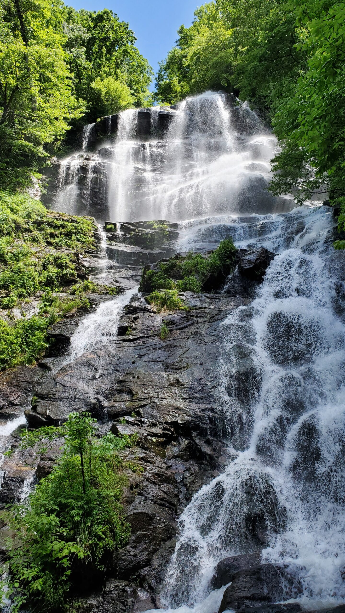
Amicalola Falls State Park is located in Northern Georgia. While we visited primarily for the Appalachian Trail significance, we were blown away by the size of the falls. Amicalola Falls is a cascading waterfall that is 729 ft tall.
Hiking
Amicalola Falls
Hiking was our central focus during our visit to the park. We parked at the bottom of the falls and hiked up hundreds of steps to the top. It was worth every foot of elevation gain to see all the cascades of the falls. Once we reached the top, we walked over to see the lodge and then headed over to the AT Approach Trail. We knew we wouldn’t have time to hike all the way out to Springer Mountain and back, but we hiked about a mile on this trail before turning back to head back down to the bottom of the falls.


Click here for a list of trails on the park’s website.
Springer Mountain
Because we knew we wouldn’t be able to hike all the way from Amicalola Falls to Springer Mountain and back in the time we had available, we planned to drive to the Springer Mountain trailhead and hike the short distance in to the designated Southern Terminus of the AT. In order to drive to the Springer Mountain trailhead, you must take a gravel forest road up onto the mountain. Depending on what direction you’re coming from, the distance on the forest road will vary. For us, it was about 6 miles.


Even though this trailhead was a ways off the beaten path, it was undoubtedly worth the trip. The Appalachian Trail was the main focus of our trip, so we were excited to see the actual marker of the start of the trail. We spent some time here taking pictures and enjoying the view. We hiked back to the parking lot and then continued on the trail for a ways before turning around. Here is a link to the US Forest Service website page for the Springer Mountain Trailhead.
Lodging & Other Activities
The park has a lodge and a campground. We camped outside the park at Morganton Point Campground to be more centrally located to our multiple north Georgia destinations. This park had many activities available: zip lining, archery, and guided hikes just to name a few. Here is a link to the Amicalola Falls lodge website, which includes details about activities within the park.
When to Visit
We visited over Memorial Day weekend and both Amicalola Falls State Park and Springer Mountain Trailhead were packed! We were lucky to find parking at both locations. I think that during the week or during a non-holiday weekend the crowds might be a little lighter.