
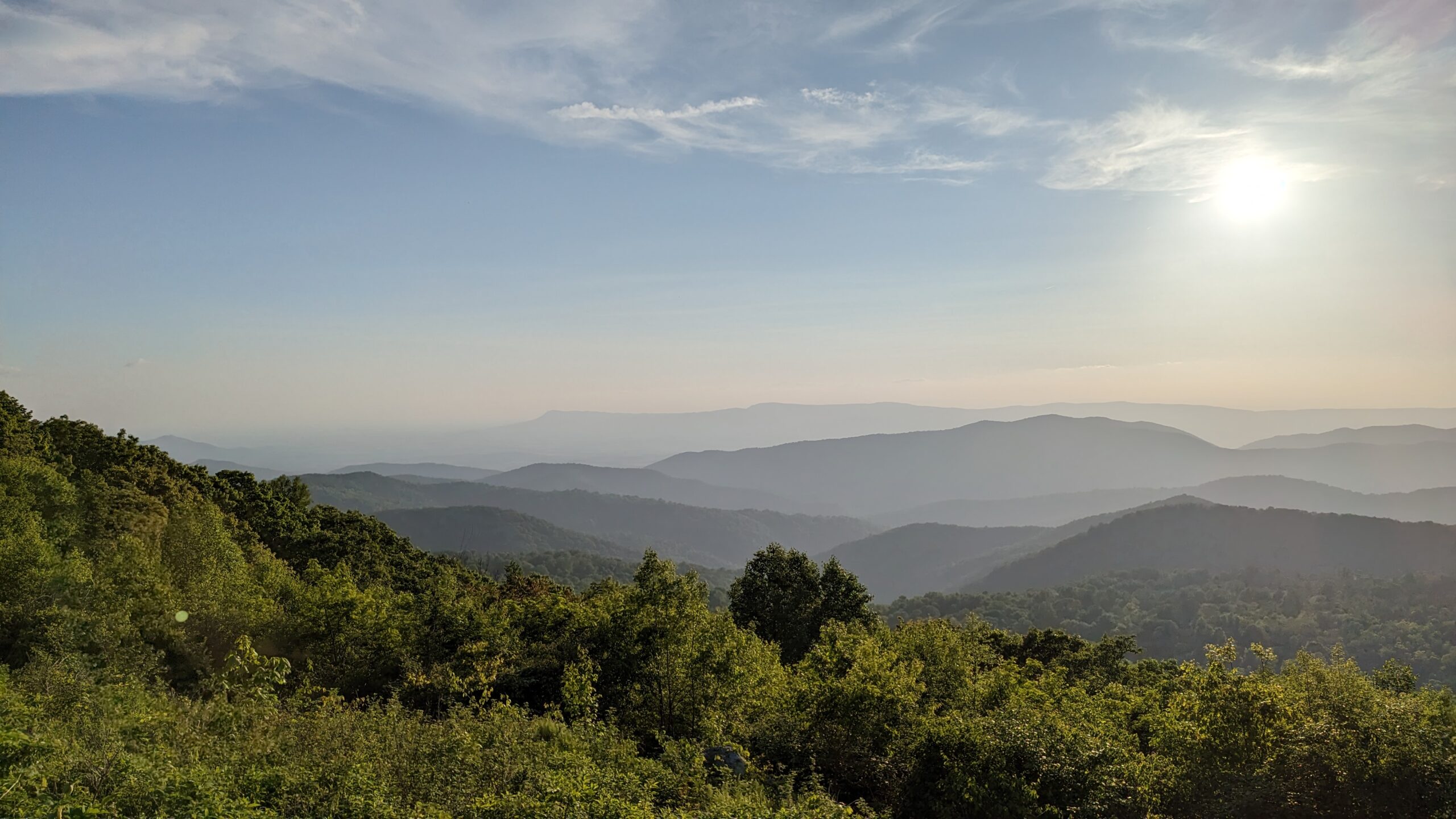
Wow! I was so impressed with Shenandoah National Park! That’s not to say I set the bar low, but it far exceeded my expectations. I wasn’t disappointed by a single hike. There were amazing waterfalls, views, and mountain climbs. The area reminded us a lot of the Great Smoky Mountains, but with significantly fewer crowds. We never had trouble finding a parking spot. We were visiting during the week, but I was still surprised at the lack of crowds compared to other parks.
Hiking
Hiking was our main activity in Shenandoah. I had a long list of hikes, knowing we wouldn’t get to all of them, but we did quite a few. Hiking at Shenandoah was amazing! The trails we hiked either had amazing mountain views or close-up waterfall encounters. Even though we did quite a variety of hikes in terms of length, they all had fairly significant elevation gain. Either we were hiking down to see waterfalls and then hiking back up to the trailhead or we were hiking up a mountain and then back down.

Most of the hikes were off the park’s main road, Skyline Drive. It was so helpful that this road includes mile markers and the Shenandoah National Park website lists the mile markers for each trailhead, so you can easily see when you’re getting close. I’ve included links to each trail’s dedicated page on the National Park Service (NPS) Shenandoah website. These pages include additional trail information and maps of each route.
Browns Gap
- Quick Facts
- Length: Approx. 6.5 miles round trip (circuit hike)
- Elevation Gain: 1,400 ft
- Trailhead/Parking: Brown’s Gap Parking Area (mile 83)
- Link to NPS site
Something I noticed right away about Shenandoah hikes is that they often mention “circuits”. From what I’ve gathered during my research and our time hiking there, you can create various circuit hikes by connecting different trails. For this hike, we started on Browns Gap Fire Road, connected to Doyles River Trail, made a right on Jones Run Trail, and then made our final turn onto the famous Appalachian Trail.


We started this hike on an incredibly foggy, misty morning. Originally, we planned to do a mountain hike that morning but decided against it due to low visibility. We certainly made the right choice because the waterfalls along this trail were flowing, and it was incredible! The hike passes three waterfalls: Upper Doyles River Falls, Lower Doyles River Falls, and Jones Run Falls. There are also several smaller unnamed waterfalls between these three major falls. The icing on the cake for me was hiking back on the Appalachian Trail.


Old Rag
- Quick Facts
- Length: Approx. 9.4 miles round trip (circuit hike)
- Elevation Gain: 2,348 ft
- Trailhead/Parking: Old Rag Parking Area
- Link to NPS site
Unlike the other hikes we did in Shenandoah, this one is not located off Skyline Drive. You actually leave the park and drive back in from the east to a special parking area for Old Rag. There are actually several ways to hike to the summit of Old Rag. We chose the most strenuous (but I would also call it the most exciting) route. Our route involved a rock scramble, which entailed climbing on large rocks and squeezing between small openings in the rocks all while searching for the next blue blaze to confirm you were still on the trail. It was tough, but it was thrilling! I think the challenging hike made reaching the summit that much more rewarding.


We started at the Old Rag Parking Area on the park boundary. First, we hopped on the Ridge Trail and followed a series of switchbacks up into the forest. Eventually, we popped out of the trees and found ourselves in a sea of rocks. This is when the views started to really get impressive. We continued along on the rock scramble until we reached the summit (which was also full of rocks). From here, we continued down until we reached the Saddle Trail. We took this to the Weakly Hollow Fire Road. At the end of the hike, we had the choice of hiking back up on the Ridge Access Trail to connect back to the original Ridge Trail or continuing down the road to the parking lot. We opted to continue to the parking lot rather than hiking back up to a trail we’d already covered.

As I mentioned previously, there are several options for hiking to the top of Old Rag. If the Rock Scramble isn’t your thing, there is the option to hike up via the Saddle Trail. It will still be a steep hike, but it will be on a trail rather than across large rocks.

Important Note: As of our visit in May 2023, Old Rag required a day-use ticket for each person. We didn’t have a problem purchasing ours in advance. There is a small ranger station at the parking area, and they will require you to show them your day use ticket(s) and pay a park entrance fee or show a park pass. Here is a link to the Old Rag day-use ticket FAQ page: Old Rag Day-Use Ticket – Shenandoah National Park (U.S. National Park Service) (nps.gov).

Dark Hollow Falls
- Quick Facts
- Length: Approx. 1.4 miles round trip
- Elevation Gain: 440 ft
- Trailhead/Parking: Dark Hollow Falls Parking Area (mile 50.7)
- Link to NPS site
We squeezed this hike in the morning the day we were leaving Shenandoah, and I’m so glad we did! We got an early start (around 7:15) and we had the trail to ourselves until one family reached the falls right as we were starting to head back up to the trailhead. I love hikes that follow creeks/rivers and this one did just that from the very beginning. It was an easy hike down to the falls. Then we spent some time hanging around the falls before heading back up to the trailhead. You can continue on the trail beyond Dark Hollow Falls to see several smaller waterfalls. Just remember, the farther down you go, the longer the climb back up to the trailhead.


Hawksbill Summit
- Quick Facts
- Length: Approx. 1.7 miles round trip
- Elevation Gain: 690 ft
- Trailhead/Parking: Hawksbill Gap Parking Area (mile 45.5)
- Link to NPS site

Hawksbill Summit is significant because it is the highest peak in Shenandoah. Similar to Old Rag, there are several ways to hike to the top. We chose the steepest, but shortest route, which followed the Lower Hawksbill Gap trail. It was definitely a steep climb, but the views at the top were worth it! There is a man-made platform, but there are also jagged rocks at the summit. There is also a small shelter near the top.

Scenic Driving
Shenandoah National Park is a long, narrow park. The main road, Skyline Drive, runs north-south through the park. It is a great scenic drive with many turnoffs for photos. In addition to these smaller turnoffs for photos, there is plenty of trailhead parking for getting out on the trail.

Skyline Drive is a long road! It runs 105 miles through the park. It is also a narrow road with twists and turns through the mountains as well as a tunnel. If you’re heading to a campground with a larger RV, keep this in mind. We tried to carefully plan our outings to visit all the areas we were interested in along a specific section of the road so we wouldn’t have to retrace our steps, driving back and forth over the same sections of the road.
Click here to read more about Skyline Drive on the NPS Shenandoah website: Driving Skyline Drive – Shenandoah National Park (U.S. National Park Service) (nps.gov).
Camping/Lodging
There are several lodges and campgrounds inside the park. We stayed at Big Meadows campground, which is centrally located in the park. It is a huge campground with both tent-only sites and larger sites that accommodate RVs. Although it does not have any hookups, it does have a place to fill your freshwater tank and a dump station. We really enjoyed our time in Big Meadows! To read more about our experience camping here, check out the campground blog post: Big Meadows Campground – Miles of Yellow Lines/

Wish List
As I mentioned previously, we knew we wouldn’t have the time to hike all the trails on my list. I always like to have more too many trails researched and prepared, so we have options to choose from depending on the circumstances at the time of our hike. I’ve included some of these additional hikes along with links to their NPS page below.
- Cedar Run – White Oak Circuit – Cedar Run – Whiteoak Circuit (U.S. National Park Service) (nps.gov)
- Rapidan Camp – Rapidan Camp (U.S. National Park Service) (nps.gov)
- Mary’s Rock Summit – Marys Rock Summit (U.S. National Park Service) (nps.gov)
- Frazier Discovery Trail – Frazier Discovery Trail (U.S. National Park Service) (nps.gov)
Nearby Destinations
We also did two hikes outside the park: Humpback Rocks (off the Blue Ridge Parkway) and the Blue Ridge Tunnel Trail. Both were a short drive south of the park. To read more about our Humpback Rocks hike, check out the blog post: Blue Ridge Parkway: Humpback Rocks – Miles of Yellow Lines. To read more about the unique Blue Ridge Tunnel experience, check out this blog post: Blue Ridge Tunnel Trail – Miles of Yellow Lines.

